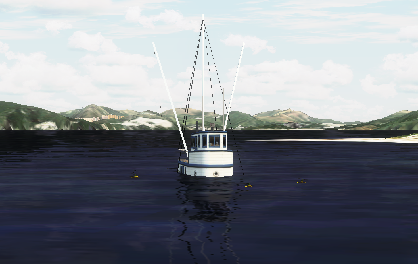
Mission M01: Search and Rescue near Pu Tai Island
Mission Type: Search & Rescue Virtual
Mission Location: 22°10’N, 114°17’E, about 41 kilometers Southwest from Hong Kong Airport.
Action Plan:
– JS41 for initial search
– AS332 L2/ EC155 BI/ S70A for search & rescue
Briefing
Virtual Government Flying Service received an alert from the Virtual Hong Kong Maritime Rescue Co-ordination Centre that a vessel, namely “Tung Chung V ”, reported sunk and request immediate rescue. The location of the fishing vessel at that time was 22°10’N, 114°17’E, which was about 41 kilometers Southwest from Hong Kong Airport. It was reported that 3 people on board..
PREPAREATION:
-Download the Navigation Charts for VFR
-Download the Helicopter
-Download the Add-on mission file

-Print Out the
(1)Navigation Charts
(2)Flight Plan in Navigation Log,
(3)Aircraft Check List.
FLIGHT PLAN: GFS- SIL – ISL – WAG – (OPS – HK24)- HAR – GRI – SIL – GFS
MISSION PHOTO: