Dear All Pilot and Fans.
Website of Virtual GFS would be temporarily closed due to technical issue with effective from 16.7.2020. All function would be suspended until further notice.
Best Regards,
For OC VGFS


Dear All Pilot and Fans.
Website of Virtual GFS would be temporarily closed due to technical issue with effective from 16.7.2020. All function would be suspended until further notice.
Best Regards,
For OC VGFS
香港管制區內有三種空域類別, 分別是Class A, Class C, Class G. 並設立Control Zone Area (CTR Zones) 及Uncontrolled airspace reporting Area (UCARAs), 所有虛擬機師須清楚了解及遵守向各空域限制,以下是從HKAIP 中的簡要,詳細請參閱http://www.hkatc.gov.hk/HK_AIP/AIP/ENR/HK_ENR2.1.pdf.
甲類空域(Class A)
(a.) 甲類空域一般位於各類空域最高層
(b.) 必須進行IFR 飛行
(c.) 須服從ATC指示及需得到ATC許可才可進入
(d.) 所有飛行器須保持安全距離
丙類空域(Class C)
(a.) 可進行IFR 和VFR飛行
(b.) 須服從ATC指示及需得到ATC許可才可進入
(c.) ATC 會提供飛行情服,讓各飛行器保持最低間隔
庚類空域(Class G)
(a.) 非管制空域
(b.) 不受ATC限制,但會提供飛行情報
除了在CTR ZONE和UCARAS空域外,在長洲 ‘CH’ DME 50 海哩以內,
空域類別 高度
Class A 8000ft 以上
Class C 2000ft – 8000ft
Class G 地面 – 2000ft
CTR ZONE
空域類別 高度
Class A 9000ft 以上
Class C 地面 – 9000ft
UCARAS
空域類別 高度
Class A 9000ft 以上
Class C 個別區域高度限制- 9000ft
Class G 地面 – 個別區域高度限制
在長洲 ‘CH’ DME 50 海哩以外
空域類別 高度
Class A 8000ft 或以上
Class G 8000 ft以下
Remarks:
進入各CTR Zones & UCARAs, 請參閱各空域之進出口及飛行限制,例如某些空域的進出口要求在某高度上飛行,或只限直昇機或雙引擎飛機通過, 詳情請參閱http://www.hkatc.gov.hk/HK_AIP/AIP/AD/HK_AD2-103.pdf
CTR Zones & UCARAS 位置請參閱
http://www.hkatc.gov.hk/HK_AIP/AIP/AD/HK_AD2-102.pdf
From Internet:
From internet
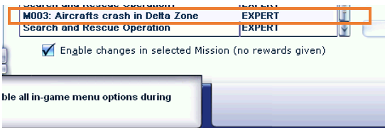
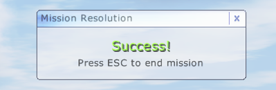
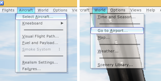
Hey, I think you got a problem how to start our VGFS mission when you are reading this thread. Here we will illustrate step by step for playing our mission.
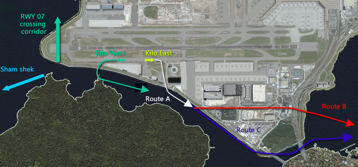
Effective Immediately Until Further Notice:
All VGFS pilot are required to follow the following exit routes from GFS Base
(1) INITIAL SEARCH – Emergency airlifting of 3 injured crews from a cargo ship : –
Virtual GFS was tasked to search for 1 missing crew and airlift 2 other injured crews from a cargo ship at 127 nautical miles south east of Hong Kong.
A Jetstream41 aircraft was used as initial search and rescue aircraft for long range operations. It will be the first to arrive at the scene and act as on scene commander
DIFFICULTY:
-Easy (for beginners)
BRIEFING:
At 0840 hours in the morning of 29 July 2003, Virtual GFS was tasked to search for 1 missing crew and airlift 2 other injured crews from a cargo ship which reported at earlier time that it had had explosion at her engine room. It was at 127 nautical miles south east of Hong Kong while the incident was happening.
A Jetstream41 aircraft was airborne at 0940 hours, it is used as initial search and rescue aircraft for long range operations. It will be the first to arrive at the scene and act as on scene commander, then guide the Eurocopter AS332 (Super Puma L2) helicopters to the scene. The helicopter will airlift 3 injured crews and back to Prince of Wales Hospital.
PREPAREATION:
-Download the Navigation Charts for IFR
-Download the Aircraft
-Download the Addon Scenery file cargoship_chery.zip
-Print Out the (1)Navigation Charts, (2)Flight Plan in Navigation Log, (3)Aircraft Check List.
MISSION:
-Initial search
-Act as on scene commander
OPERATION BRIEFING:
-Aircraft: Jetstream41
-Take off time: 0940
-Target: a cargo ship
-Location: 127 nautical miles south east of Hong Kong (between the intersections of CHERY and LOGAN)
-Flight Plan for RWY 07R takeoff and 07L landing: (VHHH-OCEAN1A-V5-CHERY-LOGAN-SABNO1A-VHHH)
-Flight Plan for RWY 25R takeoff and 25L landing: (VHHH-OCEAN1B-V5-CHERY-LOGAN-SABNO1B-VHHH)
-Flight Plan Remark: GFS SAR in Emergency
-Flight Level: 6000ft
-IFR for departure and approach in VHHH
-On scene searching: request VFR from ATC then descend and maintain 5000ft – 500ft
-Target in sight: descend and maintain 500ft then take a photo by press the “Print Screen” button
-Contact ATC again, “Climb and Maintain 6000”, “Rejoin IFR”
The new Virtual GFS website is issued
Welcome to WordPress. This is your first post. Edit or delete it, then start blogging!